T2K Pro 2.31
T2K Pro integrates the rich world of GIS datasets and transfers your Geographic information data into Google earth.
Last update
3 Apr. 2007
Licence
Free to try |
$90.00
OS Support
Windows
Downloads
Total: 1,183 | Last week: 1
Ranking
#243 in
Screen Capture Software
Publisher
Tiles2kml Pro
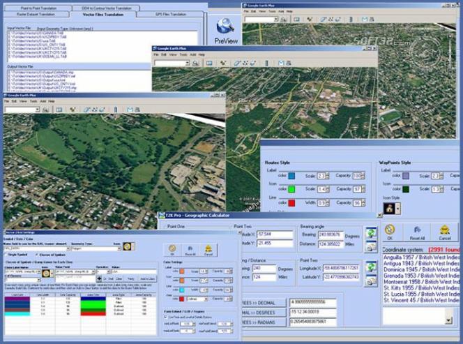
Screenshots of T2K Pro
T2K Pro Publisher's Description
T2K Pro integrates the rich world of GIS datasets and transfers your Geographic information data into Google earth. T2K Pro handles rich data types and access large volumes of geographic data stored in files and databases; T2K PRO handles raster (imagery), Vector Map data and GPS Tracks/ Waypoints/ Routes. Tiles2kml Pro provides a complete suite of conversion tools to easily visualize and convert your existing geospatial data. Tiles2kml Pro converts your raster imagery into very small tiles with different levels of detail allowing very quick view for very large datasets without losing the image quality. Tiles2kml generates very small image tiles that can be served locally on your PC or your intranet. You can even share your imagery through the internet using the customized kml files that link Google Earth client to the small tiles on your webserver. Sharing large imagery over the internet becomes a very quick and easy process.
T2K Pro performs Raster data translation for the most popular raster formats. T2K Pro Free GIS Translator allows you to easily re-project, Crop and tile your raster data in single and batch modes. T2K Pro uses "On-the-fly" map re-projection to convert your Projected GIS Data into "Geodetic Lat/Lon - WGS 84" Coordinate system in order to be viewed in Google Earth. T2K Pro supports 3000 pre-defined coordinate systems, and uses EPSG (European Petroleum Survey Group) and WKT (well-known text).
Vector geographic features such as points, lines, and polygons can be easily converted to the most popular vector formats available: ESRI (SHP), MapInfo (TAB, MIF), Geography Markup Language (GML), and Keyhole Markup Language (KML). T2K Pro converts popular vector formats into (Keyhole Markup Language -KML) files. Queries can be made to extract certain features from the vector Data and assign different kml 2.1 styles to them. Vector Map files in different coordinate systems are translated into "Geodetic Lat/Lon - WGS 84".
Look for Similar Items by Category
Photo & Design
> Screen Capture Software
This product is also listed in: Image Viewers, Digital Photo Tools, Image Convertors
This product is also listed in: Image Viewers, Digital Photo Tools, Image Convertors
Feedback
- If you need help or have a question, contact us
- Would you like to update this product info?
- Is there any feedback you would like to provide? Click here
Popular Downloads
-
 Kundli
4.5
Kundli
4.5
-
 Grand Auto Adventure
1.0
Grand Auto Adventure
1.0
-
 Macromedia Flash 8
8.0
Macromedia Flash 8
8.0
-
 Cool Edit Pro
2.1.3097.0
Cool Edit Pro
2.1.3097.0
-
 Grand Theft Auto: Vice City
1.0
Grand Theft Auto: Vice City
1.0
-
 Hill Climb Racing
1.0
Hill Climb Racing
1.0
-
 Cheat Engine
6.8.1
Cheat Engine
6.8.1
-
 Zuma Deluxe
1.0
Zuma Deluxe
1.0
-
 Tom VPN
2.2.8
Tom VPN
2.2.8
-
 Vector on PC
1.0
Vector on PC
1.0
-
 Grand Theft Auto IV Patch...
1.0.1.0
Grand Theft Auto IV Patch...
1.0.1.0
-
 Netcut
2.1.4
Netcut
2.1.4
-
 Minecraft
1.10.2
Minecraft
1.10.2
-
 Ulead Video Studio Plus
11
Ulead Video Studio Plus
11
-
 AtomTime Pro
3.1d
AtomTime Pro
3.1d
-
 Windows XP Service Pack 3
Build...
Windows XP Service Pack 3
Build...
- Bluetooth Device (RFCOMM Protocol... 5.1.2600.2180
-
 C-Free
5.0
C-Free
5.0
-
 Hercules Setup Utility
3.2.8
Hercules Setup Utility
3.2.8
-
 Microsoft Office 2010
Service...
Microsoft Office 2010
Service...